monuments melt into city

A constant phrase in my head while I visited the city was Norma Evenson’s “Chandigarh is a city of monuments, but in Brasilia, the city is a monument.” This was why it didn’t work; why Chandigarh lives and thrives while Brasilia suffers under the ever increasing weight of its newcomers.

Strangely though, as I first entered the city, my experience told me that the quote is wrong. Perhaps because I entered via the W3 commercial thoroughfare and not the Eixon Monumental, I traversed the entire length of the city from south to north with hardly the feeling I was inhabiting a monument.

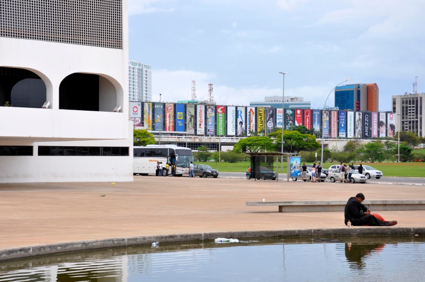
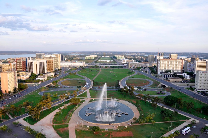
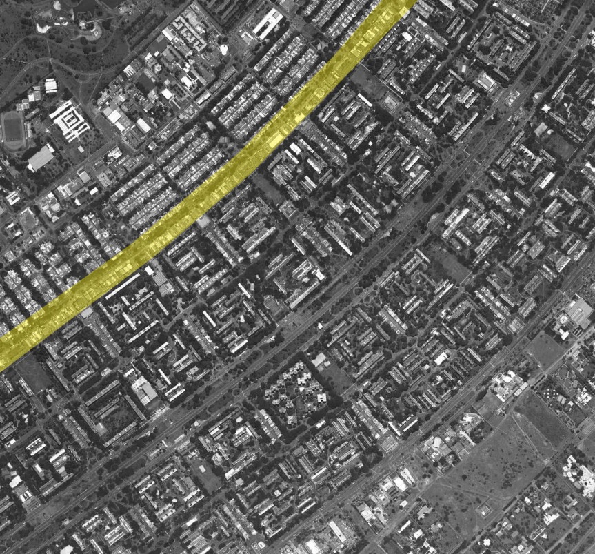
The city is divided quite distinctly between the space of the monuments and the space of living…one axis for each. The monumental axis contains almost all of Brasilia’s famous buildings, stretching from the southeast tip of the center to the western edge near Lake Paranoa. There are many vantage points for viewing the white volumes marching resolutely across the landscape; from most points within the axis they look pretty good. But when you leave, and enter the residential wing, you are in another place. You might get a glimpse of the cathedral from the L2, or maybe you’ll see part of the congress from the shopping mall, but you have left the monumental zone and entered a different type of place that isn’t so much monument as it is systematic repetition.

The architecture of the residential wings followed a similar aesthetic as the monumental axis, with pure forms and an openness reflected in the presence of clear glass and ventilated space, both inside and out. What has been the biggest difference between the two areas of the city results from the sacredness of the former, and the diverse ownership of the latter.

The monumental axis is Brasilia’s image. It is powerful and memorable and huge. It also belongs to the government, which maintains a relatively uniform approach to its architecture. On the other hand, Brasilia’s residences and commercial complexes sit under a pile of complicated ownership systems that all lend their voice to building developments. This has resulted in a cacophonous mixture of architectural styles and articulations, bursting from the seams of an oppressive corset of urban regulation.

On the ground, the divisions between these two zones are quite definite. Large embankments and open empty fields separate the borders. But when you look on to the city from afar, that powerful image simply melts into the sea of a writhing urban metropolis.

brasilia’s commercial islands

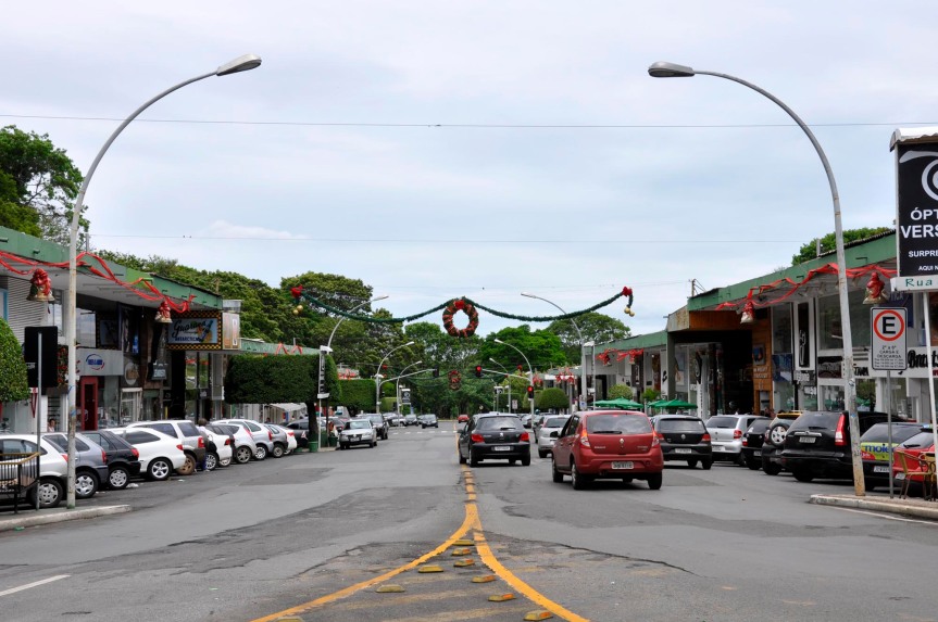
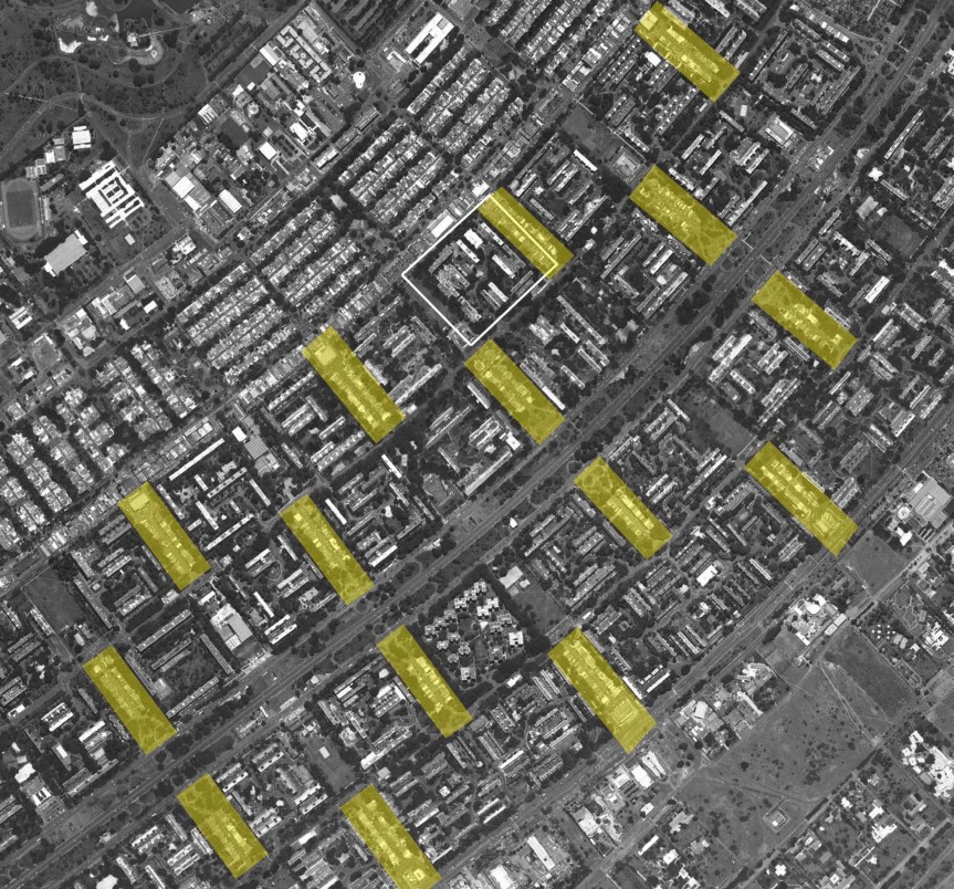
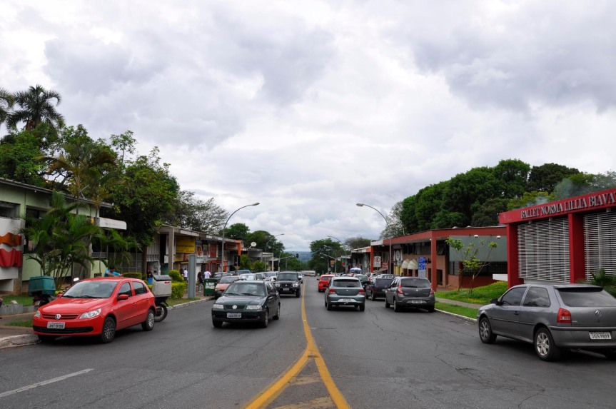
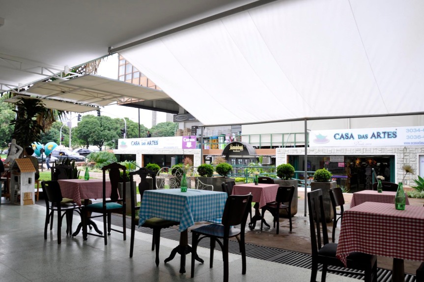
Along one side of each superquadra in Brasilia sits a commercial strip designed for everyday shops that would supply the residents of the area. Mirrored in the plan, the commercial edges of neighboring quadra meet to form a commerce street. These streets are offset in every group of four adjoining sectors so that there is no grid formed, but instead alternating isolated strips end in a large grocery store or a cultural or religious institution.

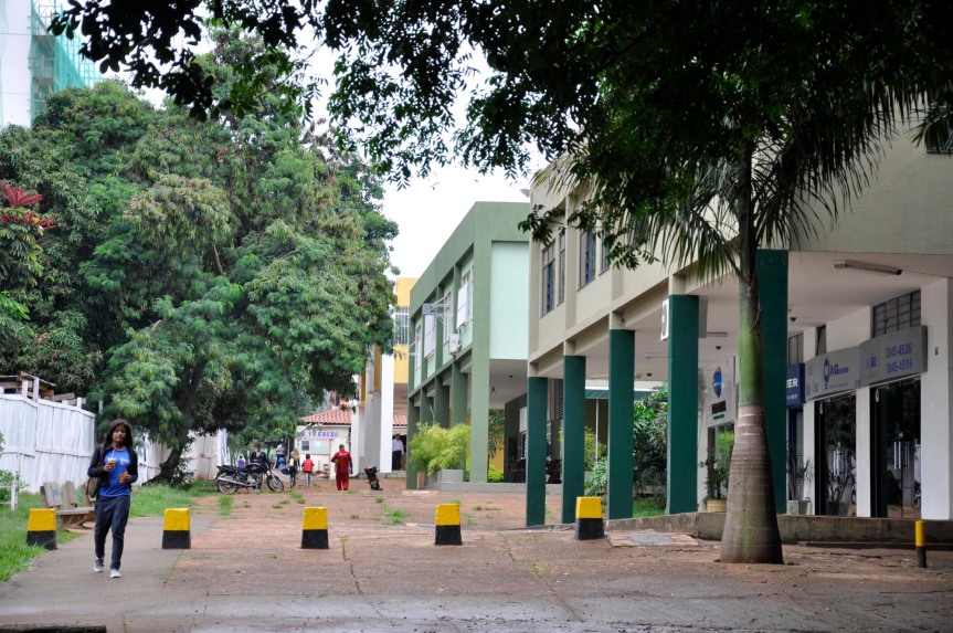
The strip architecture is made of (almost) 2 story concrete frame buildings that step down with the (artificial) terrain. Storefronts sit back from the street behind a twelve foot walkway, which is covered by a fully or partially cantilevered concrete projection from the second story that wraps the entire building. At two or three intervals along the strip the buildings open, creating a covered gap that allows people to walk through into the quadra. The ground floor storefronts open with glass facades while the second story, intended as offices but mostly used as apartments, contain fewer windows and an occasional balcony. These buildings were meant to face their superquadra while the street was meant for loading etc. However before the city was built that decision was reversed, and the commercial buildings all face the street.

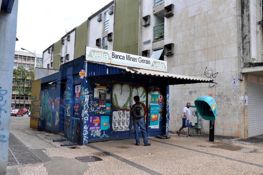
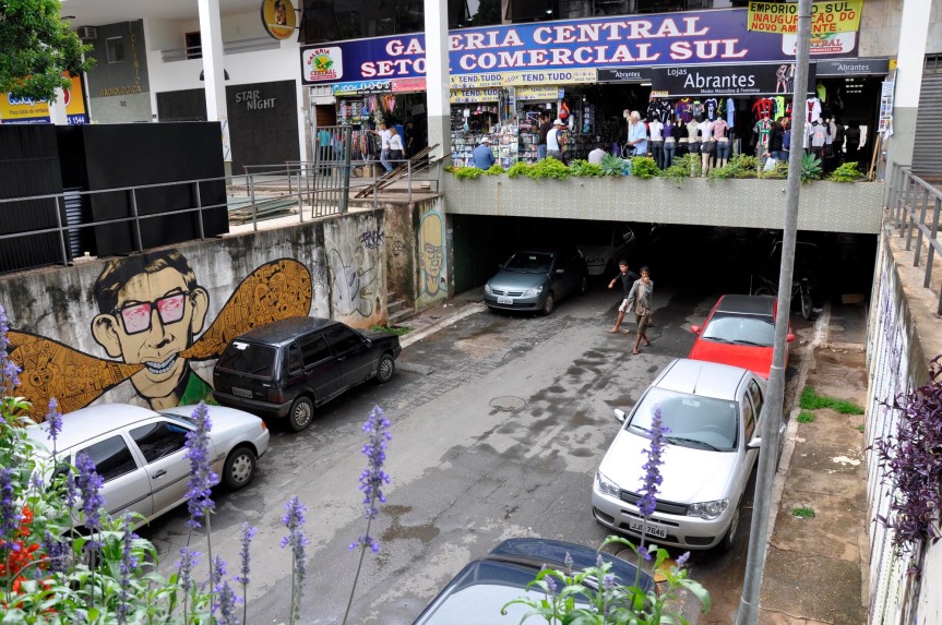
As is the case in a city, the commercial strips did not remain equal. Some, located near edges, specialized so that only a particular product can be found. Near the hospital sector at the center of town the last superquadra commercial strip became a drugstore row, where hospital patients can easily pick up their prescriptions.  Similarly, there are strips for lighting needs, mechanical needs, and fabrics, to name a few. Along with the specialization in material goods, some strips have become popular for their social scene…the right clubs, pubs and restaurants bring crowds at night.

The architecture of the strips has changed as well, in a process that went hand in hand with their specialization. Because the preservation plan and the building code specify the building perimeter and location in the lot, space allotted to a built structure is extremely valuable and not wasted. The most common changes to the buildings are shed-like additions to the rear of the building, on the quadra side. They are made from a variety of materials ranging from the cheapest corrugated galvanized iron sheets to brick and concrete. This kind of addition occurs in stores, but restaurants gather the space not to enclose it, but to create open seating. Some use the sidewalks, some use the gaps, and a growing number use the space behind as a sort of garden seating, which has begun to clean up some of the disheveled sheds. The more eating/drinking oriented, the more porous buildings remain, but the more divided the space around the plinth and on the sidewalk becomes…partitioned by fake bushes and trees, awnings and oversized signage.

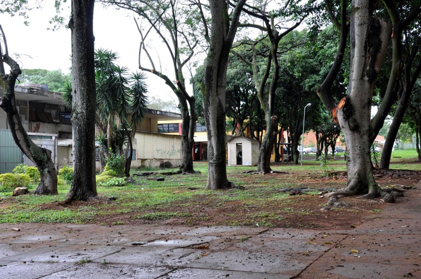
The architectural changes affect the composition of the block and the street. Divisions of the sidewalks separate thoroughfare from stopping place. The type of addition on the rear either reinforces or negates the connection to residential buildings…the more restaurants and social venues a place has the more connected and less forbidding the back of the strip becomes. In the near future this dead zone may become an active connection in some superquadra, its green space inhabited by seating and extremely localized commerce (I already saw an entrepreneurial locksmith booth behind the strip in SQS 103). But the dispersed structure of Brasilia’s superquadra has prevented any further links…these remain islands of activity.
The commerce islands float between the city’s fiercely fast thoroughfares, ultimately isolated pieces of a residentially dominated urban fabric. Here it seems that the articulation of the plan, particularly with regard to roads, is so strong that the architectural changes only operate within the confines of their specified envelope, or slightly beyond. Specialization of commerce types shows a hair more muscle through its movement of commerce or nightlife centers around the pilot plan. But these movements are dwarfed by the effect of the “shopping” metro stop, which holds Brasilia’s largest mall and draws the biggest crowds. The one commercial line running through the city could be another commercial gathering point (or string in this case) does surprisingly little…the W3 carries mostly small scale commerce that isn’t doing so well, even with the presence of the majority of the pilot plan’s buses.

Some new configurations alter the pilot plan, but in light of the highly restrictive codes and the much stronger influence of the growing satellites and their corresponding commerce, the architectural endeavors have a definitive yet small role to play in Brasilia’s aging and growth.

tolyatti today: rapid renovation

Exploring Tolyatti on foot made me realize that it is, in fact, a very large city. On the map and in the books, a rural Russian factory town seems like the kind of place you can grasp in just a few days. however, whether it is because the satellite images shows EVERYTHING at a large scale (buildings, roads, cars, sectors), or because the LADA factory has sucked up the region’s entire rural population, only once I made my way from one end to another (on bus 96; it is incredible what language barriers can bridged with a map and a pen—thanks to those at the bus stand who helped) could I grasp its magnitude.

As I attempted to follow the bus’s route on the map, I discovered the benefit of a unique feature of the map: building footprints. Without street signs and major landmarks, navigation is most easily achieved by following the building form and arrangement as you zoom past on the street!  Perhaps only I, as an architecturally inclined person, do this. However, all the buildings are numbered, and without any streets inside the blocks, these buildings become the map for negotiating the landscape—they replace the streets. They also house multiple functions along their lengths, and to access, one must move around the volume. Interior circulation plays no role in public access, except for local access of upper floor apartments.

Since I had no hope of covering the entire city in the short time there, I examined two samples closely: the east west axis of the old city and a path cutting across two sectors of the new city. These studies allowed me to get a more detailed understanding of the way the new growth (spontaneous) works with the original (planned).

OLD CITY

The apartment buildings along the east west axis of the old city (like many others I have seen!) exhibited themselves in various stages of transformation. Balconies were filled in, and open terraces had been covered to connect discrete volumes. At the base of the building, each one had acquired some sort of “skirt”: a ring of commercial outcroppings, each designed to give its owner better visibility than the other tenants of the ground floor. In some buildings, the elaboration existed only at the entry; bubbles of attachments connecting back to a single point. In others, these began to meet, sharing a wall or a railing, or the structure for a cantilevered sign. Still others had foregone the individual entries and banded together to build a building-length arcade over the remnants of previously articulated entrances. In all of them, between the entry and the street, the sidewalk contained at least a few kiosk islands, or even archipelagos.

NEW CITY

The new city is bigger and more regulated. Grid streets are not broken, and blocks inhabit their voids. On the facades of the new city some interesting work has been done. At the point where the balcony cantilevers out from the façade, many have inserted a horizontal piece to create a triangular window…which could be a seat or a shelf inside. Shops attach to every base, and new buildings have cropped up in the massive spaces in between. Building edges have been modified, and some have even developed “A” versions, an extension that is actually a new building not quite touching, that brings the end of its parent building out to meet the street.

In both old and new cities, the aggressive architecture of commercial ventures combinations with the individualization of residential units to form a messy film that grows over its blank, grey base of multistory structures stamped out along a simple road pattern. In the old city, the smaller scale of the buildings (3-4 stories) and the ten year age advantage give it a slightly more cohesive character. The new city still looks a lot like colorful aluminum toys have been scattered over the ground and stuck on the buildings.

tolyatti’s two cities

Tolyatti, located in the Volga Region of Russia, is actually two planned cities—the “old city” built in the fifties, and the “new city” built in the sixties—connected by a single, busy artery, which pumps traffic between the two, pulsing with blaring billboards along the way. A third area, the port, hangs below both at the river’s edge. Though Tolyatti was actually established in 1737 as Stavropol-on-Volga (its name changed in 1967), the construction of the Volga Hydro-Electric Power Plant in 1950 submerged the original town in a new lake. It was rebuilt on higher ground, and drew thousands to work in the new local industry. The “new city” came about after the construction of the Volga Automobile Works in 1961, which manufactures Russia’s infamous Lada cars.

At the heart of the old city there is a park, from which radiate its roads. The south side of the park borders the main east west axis, while a few boulevards complete the north south directions. A grid fills out the plan. This city, though planned, contains a mixture of high rise apartments and single family homes, something I have not seen before. Certain sections of the city were simply planned to be privately and individually developed, and while most of these zones are in separate blocks, some of the intricately detailed wood constructed houses hunker down right in the shadow of the towering slabs. The oldest apartment buildings are of brick and top off at 3 or 4 stories, clad with brick and covered with pitched tile roofs. Newer buildings in the southeast corner grow longer and taller, and discard the traditional(esque) materials for prefab concrete panels and flat terraces.

In the new city area, blocks simply march one after the other across the terrain. With hardly any differentiation in building material and a lot of mirror/copy/paste in plan, it is difficult to know when you are near the edge or in the heart. Each block is organized according to what is inside, although the streets around blocks have become increasingly important. All blocks are meant to be identical in area and shape, but are cut off at the boundaries of the city that run diagonally across certain blocks. The city center comes at the intersection of a green cross that comes through the grid just west of center, forming an open axis, and the city’s focal point. Recently, an immense, intensely decorated traditional church—one major piece that the soviet city omitted—was built at the center of it taking advantage of the open, highly visible area.

source: flickr

remembrance from russia

Who knew that updating a blog could be so difficult? I have hundreds (or thousands) of photos, drawings, words to share about my experience in Europe during June, July and August, yet have not managed to get them online. And my efforts to “stay in order” have added to the delay…as I arrive in each new place, my efforts go primarily toward preparing, documenting, processing the place I am, and my good intentions of catching up on older visits online fall apart.

So I have made a mid-trip resolution that I believe my aunt once told me with reference to scrapbooking: never try to catch up!  Stay with the present, and go back to what you’ve missed when you’re satisfied with what is current. Long ago I gave up on scrapbooking, a brief phase in middle school when the Creative Memories craze hit the Midwest. But I think I can apply this to my blog, and the balance of traveling, researching, and attempting to both process and communicate while also seeing and experiencing.

I am coming home soon for a brief break, to celebrate my offshore wedding last January with family and friends in Michigan. Just now I am traveling via overnight train from Kazan (the capital of Tatarstan, and the former home base to Chingghis Khan’s empire that I stopped to check out on the way back from Tolyatti, the planned factory town for Lada cars) to Moscow, and the new train car has an outlet! While I move I will revisit a sampling of my experiences in Europe, and you’ll have to be satisfied with that much until I come back with more detail in the near future.

After Paris: Randstad, Netherlands (the urban region in the west/southwest of the country, located mostly in reclaimed land)
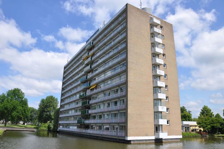
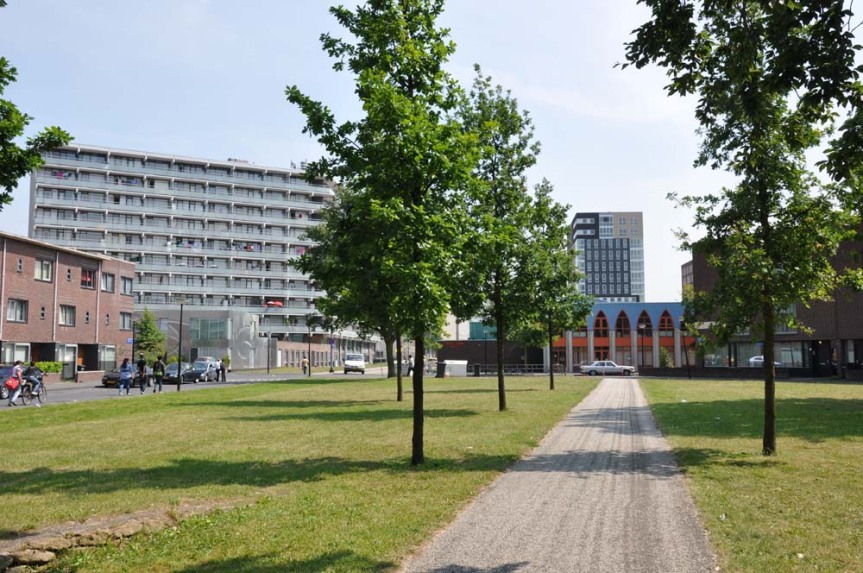
The Netherlands are completely planned. Little is left to the average person, and urban designers are everywhere. What I saw was varied institutionalized, but also creative overhauls of experimental projects of the mid century. In many scales, from the village of Hoogvliet to the Leijnband in Rotterdam, and Bijlmermeer and Nieuwe West in Amsterdam, a large actor had come in to revamp what was deemed out of date, out of place, or run down.

The next move: a train ride to Berlin, via a 90s rock cover band festival on the riverbank in Bremen.

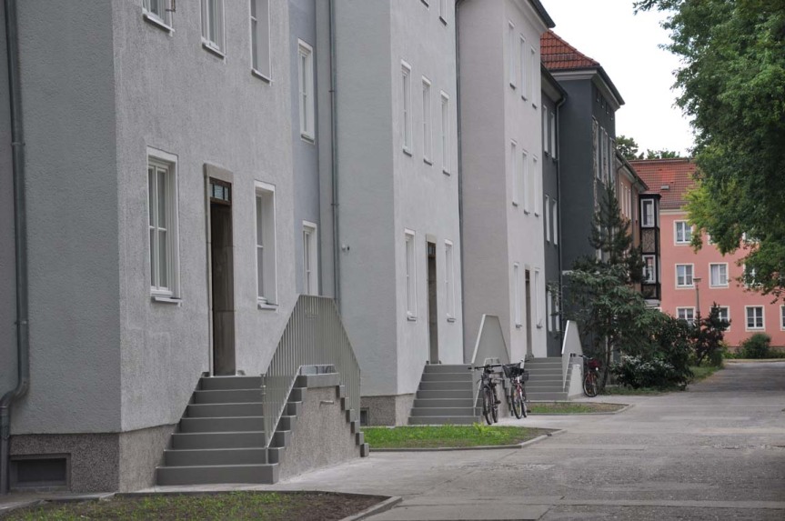
Berlin, one of my favorite cities, (maybe in part because I speak German and can feel slightly less like a tourist) moves fascinatingly, layer upon layer, somehow without losing the past, or stifling the present. The neighborhoods of the interwar years, now memorialized with a preservation plan and a well guided tourist walk, show both the insertion of a major urban sector—built both to glorify the state and to give starving workers something to do—and the inhabitation of it after the fall of said empire. But my main focus was actually a town outside Berlin, just across a river from Poland: Eisenhüttenstadt, East Germany’s first planned town. An early experiment, the town is constructed with then-new methods of concrete frames and a larger scale of building, but its urban layout is a blown up version of the traditional courtyard-street structure, with open spaces on order of CIAM’s dictates. A dying town whose steel industry has all but left, this forgotten place is dealing with issues of maintenance and destruction, and the needs of an aging and disappearing population.

An overnight train, a few Herzog and deMeuron buildings in Munich, and a day time train a few days later ran through the Alps and brought me to Ljubljana.

A beautiful city that wraps along its tiny riverbank, the place was less an example of a modified plan than a collection of careful insertions meant to guide, or maybe just influence the developments. Its past of passing through empires, one Socialist, left its marks as the city transformed.

August: Italy. First stop: Urbino (via one day of wandering in Venice…we had to change trains there anyway.)
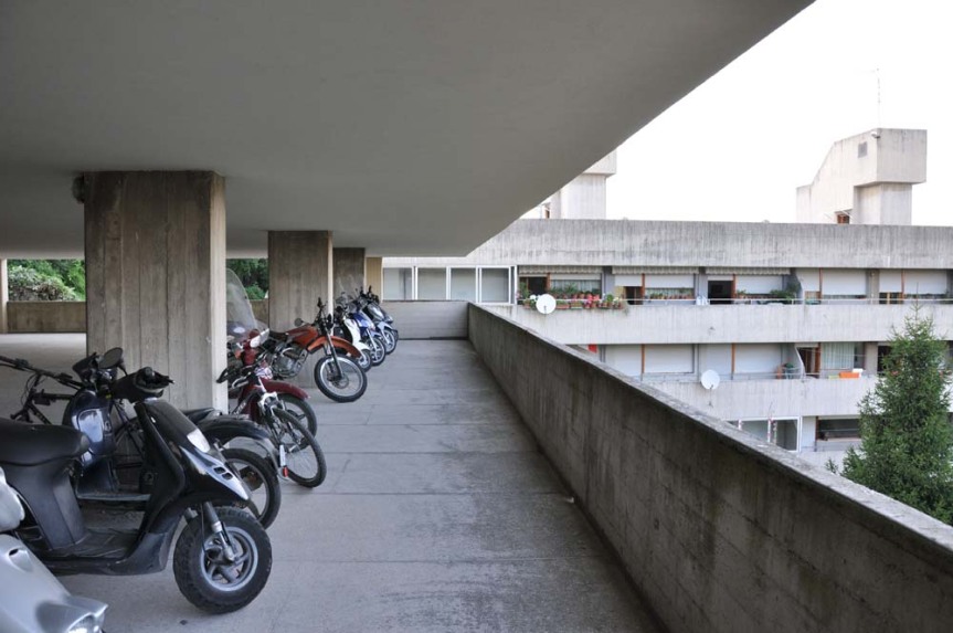
A tiny city on a hill, Urbino, the home of Raphael and a glorious Ducal Palace, was of interest to me for the zones outside the walls, designed by Giancarlo de Carlo. He is known for the student housing at the University, which I visited, but more in line with my work was the zoning plan he did for semi-urban regions on the hills that flank the city. Designed with a careful study of the urban structure of the old city, these buildings were to uphold existing patterns of use and development in a big, concrete open way.

Second stop: Latina (but before it, a visit to Florence and Rome, and a visit from my parents)
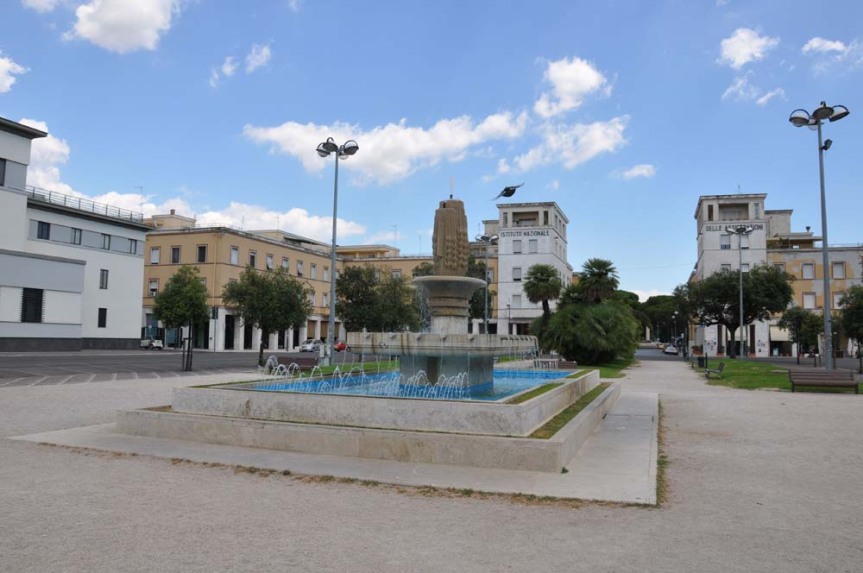
Mussolini built Latina. It was one of the Fascist towns in which he planned to re-occupy rural Italians. The plan is octagonal, ending in a public square around which the city buildings are sited. Streets radiate from the square, and many things are symmetrical. Latina once was rural, and now is overgrown, and the chaos of the growth has begun to break down the dominating axes, though not much.

Third stop: Venice again, this time for the Architecture Biennale. Thank you Chelsea for inviting me!

The exhibits often dealt with ephemeral qualities of architecture, whether it was elements of sound, light, air, acknowledgement of simple, efficient means of construction, or the memory of human presence on architectural elements. The simplicity of concepts and the reduction of material hit me the hardest.

Then I crossed an old and mostly invisible wall, into post-Socialist territory, where I am still sitting tonight, and crossing miles and miles of large open fields, skirted with the thin trunks of birch forests. But first I went to Belgrade.
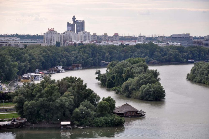

Belgrade is a fascinating place, sitting just at the edge of empires throughout its history, rebuilt (as many locals will tell you) 38 times from its ashes, its layers come from East and West, Socialist and Capitalist, and draw on Europe and Asia, international commerce both formal and informal, to shape a city that truly waivers between worlds, both past and present, and whose present and future (with respect to a complicated history) might be mined for lessons about what is in store for a world with both increasing polarization and decreasing physical segregation.

In brief, Belgrade was originally Serbian but belonged to the Ottoman Empire for 500 years, literally overlooking the Austro-Hungarian Empire on the other side of the river Sava. It gained prominence again as the capital for the new nation of Yugoslavia, which danced between the Soviets and the West, the only gate into the world of socialism, or vice versa, into western capitalism. It was then that Novibeograd (New Belgrade) was built, which brought me there. Since Novibeograd’s conception and partial construction, Yugoslavia fell apart, and after a period of war, Belgrade, of which Novibeograd is now a large and growing piece, again became the capital of Serbia, which is gaining more and more access to the European Union.  Just this year its citizens were allowed visa-free entry to EU countries, which is sure to prompt some major population shifts.

I flew from Belgrade to Moscow, and took a train to St. Petersburg, where apart from eating copious quantities of borsch, I visited the only Constructivist neighborhood to be built in Russia before Social Realism took over: Narvskaya.


Then I rode back to Moscow, flew to Samara and took a bus to Tolyatti, known affectionately to some as Lada-land. Far bigger than I thought, Tolyatti’s concrete slab blocks and green parks are quickly being grown over with vegetable stands, bay windows, colorful kiosks, supermarkets, karate studios, sushi restaurants and fancier and fancier residences that gravitate toward the large and busy streets.

I spent a few days there, and hopped a bus to Kazan, whose train I am on now, remembering the convoluted and constantly shifting loop that took me here.

cité: sarcelles & haussman’s paris

Source: “Le Grand ensemble: entre pérennité et demolition.” Exhibition, Ecole Nationale Superieure d’Architecture Paris-Belleville

In my entries on France I have been discussing the sluggish and often restricted developments of some of the country’s modern projects, known in French as cité. I want to step back now and put these developments (which culminated in the Grand Ensemble) into the context of twentieth century France. To do so I am using the example of Sarcelles, a Parisian satellite, and its position in response to Haussman’s Paris.

Haussman began the production of modern housing in Paris already in the 19th century. His plan for Paris is well known for the boulevards that cut through the medieval city, but he also standardized construction, making it affordable to rapidly build new housing (this is why the houses of the wealthy are explicitly stylistically different—it highlights them as custom made). But the modernized construction process still upheld a class-based hierarchy, one that the modernists behind the Grand Ensemble of the mid 20th century wanted to destroy.

The social hierarchy was embedded in the built form, organized by the section of the building. Basically, the first floor of the building is for the most important people, and the further up in the section you lived (no elevators), the lower your status. In a typical commercial district, the ground floor housed shops, while the shopkeeper, or perhaps the doorkeeper, lived in a mezzanine level squished between the shop and the first floor, where the nobility lived. Here the highest ceilings are located, visible through tall windows on the street that open onto generous balconies. Above the noble floor are two or three “apartment similar,” for regular people. The top one may have a smaller balcony, making it more prestigious than the other “similars” but not as nice as the noble. Finally, in the attic, lived the maid. The coldest and longest trek, this space was the lowest on the social ladder.

The response: all floors made the same. Identical apartments, regardless of their position in the building, were a key component in the high rise slab buildings. The creation of the elevator should have further equalized the spaces, because the walk to the top was no longer an ordeal.

Building organization in Haussman’s and earlier was based on courtyards. The perimeter on the street was built, while the building protectively wrapped the private green space within.

The new modernist planned projects inverted this relationship. It provided ample light and air to all residents (a problem of the medieval city), but it also eliminated private open space, placing buildings individually in a fluid ground plane that was intended for everyone.

When seen as response to the particular evils of Haussman’s Paris, these buildings that now are known for drab monotony make more sense. Certainly some of the problems and the differences could not be accounted for in advance, but following where they came from places them much more into the history of the place, rather than in opposition to it. Now that the situation has shifted, and the towers are the existing condition against which both residents and city officials are reacting, a new approach is necessary.

SARCELLES

(upper photo) Source: “Le Grand ensemble: entre pérennité et demolition.” Exhibition, Ecole Nationale Superieure d’Architecture Paris-Belleville

Nicknamed the American City, a consequence of the city’s streets lined with midcentury towers, Sarcelles is an isolated island at Paris’ fringe. It was built in the 1950s and its inhabitants are mostly immigrants and occupy the lower economic brackets of French society.

Nicknamed the American City, a consequence of the city’s streets lined with midcentury towers, Sarcelles is an isolated island at Paris’ fringe. It was built in the 1950s and its inhabitants are mostly immigrants who occupy the lower economic brackets of French society.

Sarcelles deals with many of the problems that Toulouse Le Mirail grapples, but in this city there seems to be more happening to improve the condition, perhaps because of its proximity to Paris and the increasing property values in the suburbs as Paris continues to sprawl. The major project happening right now is a renovation of the western portion of Sarcelles’ main boulevard. Previously designed as a thoroughfare that sharply divided the heart of the commercial district, the city is now narrowing the street and creating parking along the edges, as well as designating more space for pedestrian movement among planted trees. It is a method often seen around the US as cities work to revitalize their centers.

There were few inhabitants’ interventions, and the small commercial additions located off the main drag were boarded up, no longer in use. The most active area in the town was at the train station, where there is a thriving market. Like most of the residents of Sarcelles, I took the train to get there. Because I had read about the city’s problems and its attempts to revitalize, I was surprised to arrive in the middle of such activity. The market begins at the exit of the station, and extends west for about half a kilometer, parallel to Sarcelles’ main commercial drag. The street it occupies is a residential one that weaves between apartment slabs. I followed the market into the city and had to cut through a green space to get to the main commercial street. On the way back I tried to follow the commercial street over to the train stations. I walked through a fairly scary parking lot accessed by a well hidden and steep ramp sans sidewalk.

This seems like an opportunity. In a city whose residents primarily use the train, and who already have established a new (and successful) commercial area, rather than rework the old auto/pedestrian area (far away from the train station), it would make sense to strengthen the connections between the market and the commercial district, and to connect both to the train station. The residents of Sarcelles have been its regeneration; the city could simply build from their initiative.

the unpredictable power of commerce

the recent past preservation network, an organization that promotes the preservation of (and therefore research about) buildings of the recent past, invited me to write an article for their newsletter. I wrote it  as I finished the first half of my trip, to reflect on some of the trends I saw emerging.

If you are interested in reading it, you can find the article here: http://recentpast.org/news/rppn-bulletin/rppn-bulletin

As always, comments welcome!

pessac: stifled alterations

On the way to Paris I made a quick stop in Bordeaux to visit Pessac, the town where Le Corbusier’s first housing project is located, commissioned in 1924 by a forward thinking businessman, Henri Fruges, who wanted to provide well-designed housing for workers. I was interested to see the site because it is the subject of a study by Philippe Boudon’s book Lived-in Architecture: Le Corbusier’s Pessac Revisited, which documents the various alterations residents have made to the development over its then forty year lifetime.

The changes I saw followed a similar pattern to other cities I have visited: at a minimum people have added paint and covered balconies, while more aggressive residents filled in the horizontal strip windows, adding shutters, covered flat terraces with pitched roofs to prevent leaking, or constructed an additional “lean-to” between the building surface and the property’s edge. All these are dealt with in more detail in Boudon’s book.

A slightly more frightening development here is the introduction of preservation requirements. Now, if residents want to fix anything in their house, in order to get the building permit they must agree to bring the house back to its original form, right down to the paint color. For some, little more is required than a coat of paint, but for most it is a far more daunting task that will substantially decrease their enclosed floor space! Because of the new requirements, they simply wait, putting repairs off as long as possible.

le mirail: regulated change

In Le Mirail, a look at the past and present (with thoughts for the future) has illustrated a planned city that was really only half-finished. Since this particular concept depends on the connectivity of all the pieces, it is hard to pin the issues of the place on lack of appropriateness of the plan.

Problems here are both architectural and institutional. While the architectural issues can be (and are being) addressed through a careful observation and response to trends within the satellite city, there are larger institutional issues that need to be resolved just to allow these architectural changes to take place. The biggest is a blind organizational structure that over-regulates stifles meager attempts at revitalization.

The changes that happen are largely dictated by regional or even national policies that have little to do with the particular situation of the city itself. And since Toulouse has followed France’s de facto policy to put all immigrants and low income group people outside the city, in this case in Le Mirail, the area has little economic diversity, no voice and hardly any extra energy to spend on group dynamics and political struggles. Therefore, all major changes have been regulated from above, and with the exception of the metro system, have had mediocre effect in changing the place, for better or worse.

One particular issue I see in designs to update or fix Le Mirail is in their scale. Every change, from the demolition of the pedestrian deck and French town replacement in Bellefontaine, to wholesale destruction of the towers themselves, is massive. At the same time, incremental interventions are smothered by strict regulations and expensive renovation requirements.

But let’s say that the government of Toulouse decides to defy France’s pro-demolition policy and rework Toulouse-Le Mirail, details first. What are some of cues in the way the place is now used that can inform its evolution?

The 3 metro stops in the area have reconnected Le Mirail to the city center of Toulouse, its first move away from isolation. In some way, the underground connection has replaced the lost pedestrian deck, by connecting people, and not their vehicles, to the three commercial centers. Although the university housing may have suffered from loss of students to city center apartments, the rest of the region only stands to gain business from this connection. Each area already has a commercial center that is somewhat active, but could expand a great deal even to meet the needs of inhabitants.

With regard to buildings, it is easy enough to add pieces, though few residents have done even that. However, because the structures were built with load bearing concrete panel systems, it is difficult to subtract anything from the mix. While anything besides aesthetic touch ups would require major work, projects to update these towers could focus more on strategic demolition, or the implementation of a second structural system to allow partial removal of the first.

The vehicular system needs attention. Designed to separate people from cars, the roads wrap the residential edges, cutting off this piece of the urban fabric from the rest of the city, which by now has grown out to it. A disorienting hexagonal system discourages non-residents from using the roads as thoroughfares, reinforcing the enclosure. Since the elevated decks have already mostly been dismantled, it is time to reconsider the ground, and pedestrian relationships alongside and between the roads. Already some sidewalks have been laid, but the path network can be much richer…it is already growing if you pay attention to the dirt tracks worn through lawns.

ground space

Designed into parts of the plan and increased by platform dismantling, open spaces at the ground have infiltrated and perhaps intend to take over the now semi-urban plan.

Concrete Logistical requirements grouped cars at the edges of built complexes.

Concrete (interspersed) gardens and paths are designed near high towers.

Concrete block construction is revealed in the destruction of a wall.

Concrete (breaking) pre-cast benches pepper the landscape.

Concrete (breaking) paths through the planned gardens in Reynerie.

Concrete roads leading to the towers, flanked by parking lots.

Concrete (overflowing): Despite ample space, cars park in green areas.

Permeable paths worn between housing clusters.

Permeable (growing) unused garden spaces slowly grow wilder.